ENG
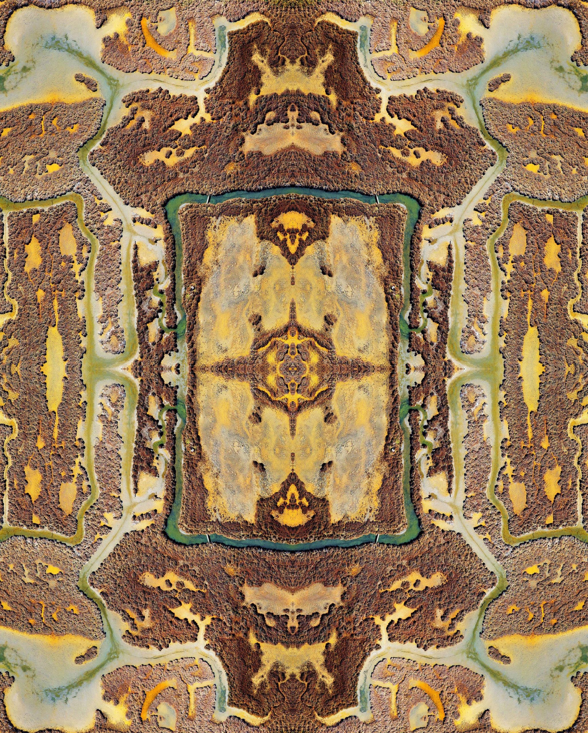
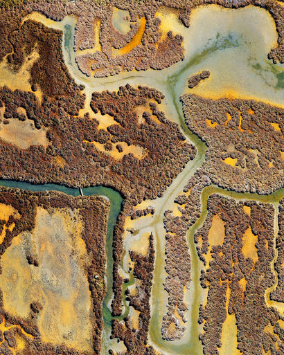
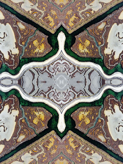
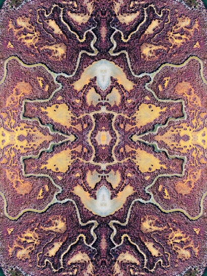
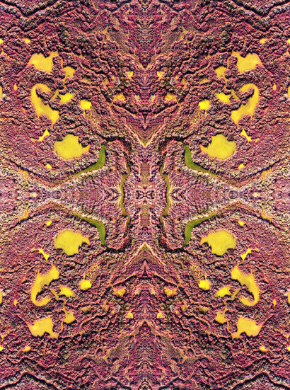
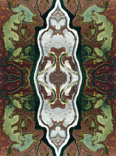
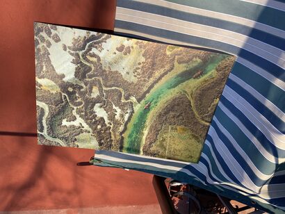
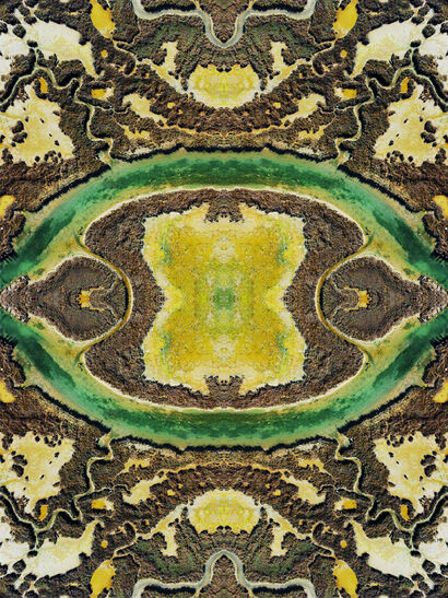
A mirror image of the sandbanks of the Venice lagoon. Aerial photography and digital manipulation create new shapes and geometries of a unique landscape to explore and admire.
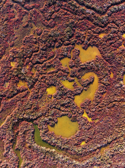
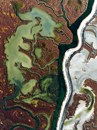
The sandbanks of the Venice lagoon are typical tabular lands with their own characteristic ecosystem. The tides regulate the flow of water that enters and leaves the lagoon, forming with their natural strength minor canals, called ghebi, which connect the innermost areas to the main waterways.
The ghebi have a significant role in the lagoon ecosystem, regulating the water supply both during high tides, with drainage functions, and during low tides, allowing the passage of water even in the innermost areas. They also help mitigate the erosive effect that the incoming tides have.
The sandbanks are characterized by colors that change according to the seasons, the tides and the reflection of sunlight. Its flowers paint the ground purple when they open and, flanked by ghebi or salt pans, create a spectacle of colors and geometries that can be admired in a particular way through aerial photography.
A territory that has unique lagoon and marsh characteristics is increasingly turning into a part of the sea. In just over a hundred years, the extension of the salt marshes has drastically reduced, reaching a reduction in surface area of up to 70%. This is due to the deviation of rivers, to soil erosion, but above all due to anthropic intervention.
The marshy environment is quickly giving way to the sea, seriously endangering the stability of an environment and of the structures that men have built over the centuries.
ITA
Una visione speculare delle barene della laguna di Venezia. Fotografia aerea e manipolazione digitale creano nuove forme e geometrie di un paesaggio unico da esplorare e ammirare.
Le barene della laguna di Venezia sono tipici terreni di forma tabulare con un loro caratteristico ecosistema. Le maree regolano l’afflusso d’acqua che entra ed esce della laguna, formando con la loro forza naturale dei canali minori, chiamati ghebi, che mettono in comunicazione tra loro le zone più interne alle vie d’acqua principali.
I ghebi hanno un ruolo notevole nell’ambito dell’ecosistema lagunare, regolano l’apporto idrico sia durante le alte maree, con funzioni di drenaggio, sia durante le basse maree, permettendo il passaggio dell’acqua anche nelle zone più interne. Contribuiscono inoltre a mitigare l’effetto erosivo che hanno le maree entranti.
Le barene sono caratterizzate da colori che cambiano a seconda delle stagioni, delle maree e del riflesso della luce solare. I suoi fiori dipingono di viola il terreno quando si schiudono e, affiancati ai ghebi o alle saline, creano uno spettacolo di colori e geometrie che possono essere ammirate in modo particolare tramite la fotografia aerea.
Un territorio che ha caratteristiche uniche di laguna e di palude si sta trasformando sempre di più in una parte di mare. In poco più di cento anni l’estensione delle barene si è drasticamente ridotta, toccando una riduzione della superficie anche del 70%. Ciò a causa della deviazione dei fiumi, all’erosione del suolo, ma soprattutto dovuta all’intervento antropico.
L’ambiente palustre sta velocemente cedendo il posto al mare, mettendo in serio pericolo la stabilità di un ambiente e delle strutture che gli uomini hanno costruito nei secoli.